Everything You Need to Know About Idaho’s Strange Concrete Arrows
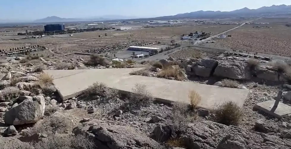
When you’re traveling, you love grabbing a window seat on the plane so that you can enjoy the views below. Chances are that if you do that enough, you’ll see one of these mysterious concrete arrows. There are dozens of them seemingly scattered around the United States, including in Idaho.
The one closet to Boise is about two miles south of Micron. Keep going another twenty miles and you’ll another past the Stage Stop. At over 50 feet long, they’re quite the sight. They’re old. They’re weathered. Nature has tried to reclaim a few of them. With many of these arrows located in remote deserts in the west, it’s only natural to wonder “Where did they come from?”
The arrows first appeared in the mid-1920s, long before pilots had access to technology like GPS or satellite to help them navigate their way across the United States. They had to rely on the ability to spot landmarks from the sky to make their way to their final destination. That was easy enough to do during the day, but after nightfall? Flying was nearly impossible.
That was unacceptable to the postal service team working to figure out how to quickly get mail from coast to coast by air. The concrete arrows were part of the solution. According to an article on Conde Nast Traveler, the arrows were built and painted bright yellow-orange color to literally point pilots along the airmail route from New York to San Francisco. Each arrow site also had a tower with a beacon light on top of it and a generator shed to keep the beacon lit in the dark. The sites were spaced out 10-25 miles.

With the new system in place and a new ability to fly at night, pilots were able to make the cross-country trip in less than 48 hours rather than days. Boise wasn’t along the original route but was added to a smaller contract air mail route running from Salt Lake to Pasco, WA. That’s where the arrows near us come from. You’ll also find arrows near Pocatello, Idaho Falls and Dubois, which were all along an airmail route spanning Salt Lake to Great Falls, MT.
As aviation technology evolved, this incredibly cool path across America became obsolete by the 1940s. According to Smithsonian Magazine, many of the towers were scrapped so that the metal could be used for World War II efforts. The arrows? While many are neglected, they’ve survived.
Brian and Charlotte Smith run a very cool page called Arrows Across America where they share photos of arrows they’ve photographed. If you’re interested in seeing some close-up or done shots of the arrows and remaining beacons, it’s worth checking out HERE.
We gathered up some Google Maps images of the ones in Idaho. Just remember that many of these arrows and beacons may be on private property. DO NOT TRESPASS to see them!
Arrows Across Idaho
KEEP READING: Eerie Video Shows What's Left of One of Idaho's Most Unique Ghost Towns
10 of Idaho's Most Mysterious Places Hiding in Plain Sight
More From 107.9 LITE FM


